Friday, June 26, 2026
News and Views from the Global South
NICARAGUA: Nature as a Sword of Damocles
José Adán Silva
- More than 1.8 million Nicaraguans are at high risk due to the various natural disasters that strike this Central American country, according to Civil Defence authorities.
Back in March, prompted by the tragic earthquakes of Jan. 12 in Haiti and Feb. 27 in Chile, leftist President Daniel Ortega issued an urgent order to the armed forces to set up a permanent commission to help the country confront natural disasters.
According to the 2010 Special Plan for Natural Disasters, which Civil Defence delivered to President Ortega earlier this month, approximately one million people who live near the Pacific coast are in grave danger in the case of a strong earthquake.
Brigadier General Mario Perezcassar, head of this specialised army corps, told IPS that Nicaragua, with a population of nearly 5.7 million, is categorised as a “multi-threat” country due to the numerous risk scenarios from quakes, volcanic eruptions, landslides, floods, hurricanes, forest fires and tsunamis.
There are some 123,000 people, living on 1.5 million hectares of forest, who face the threat of forest fires during Nicaragua’s dry season, from November to April. The threat was intensified in 2007, when Hurricane Felix upturned millions of trees, creating a vast tinderbox.
According to Plan Earthquake, based on calculations by the military, 48 municipalities are at high risk, largely along the Pacific coast. “There are slightly more than a million people concentrated along 427 kilometres of the Pacific coastal zone,” said the military commander.
The area of highest risk is Managua, which suffered major earthquakes in 1931 and 1972, each claiming thousands of human lives.
The nation’s capital is home to more than 1.5 million people and is criss- crossed by 18 seismic faults. Twenty-five percent of the infrastructure is considered “vulnerable and obsolete.”
According to the city of Managua’s Urban Planning Department, houses are the most vulnerable structures. Poverty has led to spontaneous settlements, built without regulation or adherence to construction standards.
An estimated 200 poor communities and neighbourhoods, with more than 300,000 people living in crowded conditions, are situated on Managua’s fault lines.
A study by the National System for Disaster Prevention, Mitigation and Attention, presented in January, estimated that a quake in Managua registering more than 6.9 on the Richter scale would leave 30,801 people dead, 123,202 injured and 317,304 homeless, as well as 42,884 homes destroyed or severely damaged.
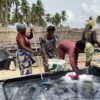
Civil Defence also found that the disasters most likely to occur are floods and hurricanes.
Plan Winter, which like Plan Earthquake forms part of the 2010 Special Plan for Natural Disasters, was launched in May, the start of the rainy season, and covers 76 high-risk municipalities. It identified 1,036 “critical points” that are prone to flooding, with more than 709,000 people at risk.
Of the areas studied, the most vulnerable are Managua and the two Autonomous Regions of the Nicaraguan Atlantic, located on the Caribbean coast.
The Nicaraguan capital, situated in a valley surrounded by hills and next to Lake Managua, has 114 kilometres threatened by landslides and flooding, endangering hundreds of homes, according to Plan Winter data.
As for hurricanes, there are more than 350,000 people in constant danger in 74 communities along the Caribbean coast.
The governmental Nicaraguan Institute for Territorial Research, which oversees meteorology, has forecast for 2010 as many as 15 tropical storms and eight hurricanes, of which four could be intense.
Civil Defence also has a plan for tsunamis, identifying and monitoring 24 high-risk sites, and has set up early-warning systems on the six active volcanoes near the Pacific coast.
In a conversation with IPS, scientist and environmentalist Jaime Incer Barquero described Nicaragua as “one of the most explosive countries in the world.”
“It’s located on an active volcanic chain and geographically situated in a natural corridor for hurricanes and climate phenomena that move along the Atlantic coast each year,” he said.
According to Incer’s book “Natural Disasters of Nicaragua,” of the 29 biggest catastrophes that occurred in Latin America and the Caribbean between 1972 and 2007, nine took place in this country.
Out in the Pacific Ocean, 150 kilometres from shore, lies the boundary of the active Cocos and Caribbean tectonic plates, which have generated the strongest earthquakes in Central America in the past 200 years.
According to Incer, Nicaragua has one of the world’s highest probabilities of death from natural disaster, taking into account that in a highly seismic country like Iran the rate is one out of 23,000, and one out of two million in the quake-prone western U.S. state of California.
Faced with the variety of threats, the army and the institutions that make up the National System for Disaster Prevention, Mitigation and Attention have conducted 95 organisational and training activities in 145 municipalities.
More than 1,200 disaster drills have been conducted, involving 12,000 emergency experts and volunteers, 12,000 military personnel, and a network of support from police, firefighters and medical teams.
 Print
|
Print
|